
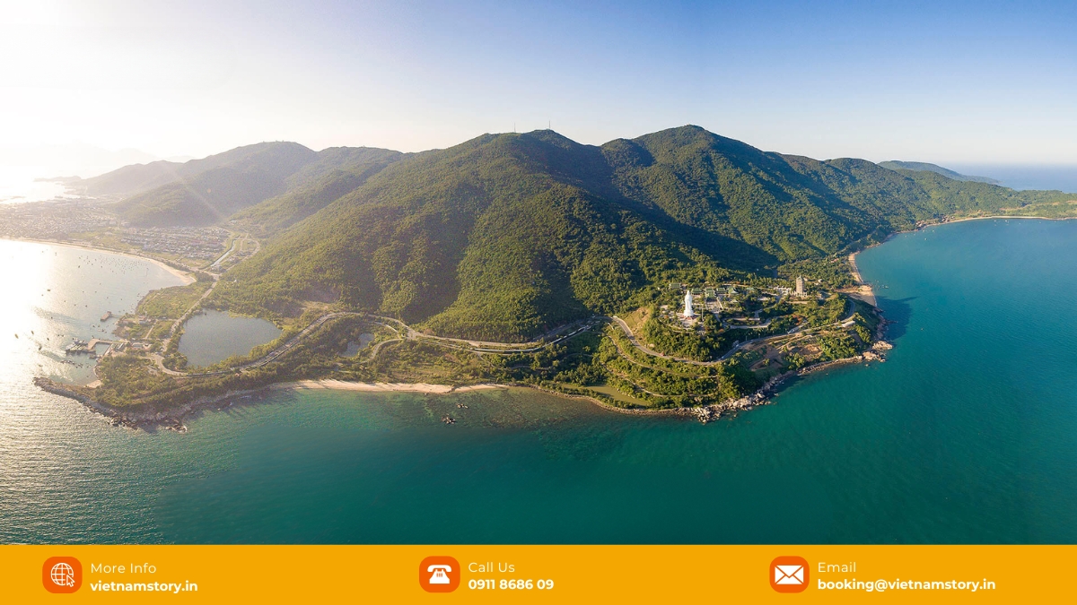
Son Tra Peninsula is best planned as a route, not as a checklist of every viewpoint, beach and forest trail. The peninsula sits northeast of central Da Nang and combines Linh Ung Pagoda, mountain roads, viewpoints, protected forest and habitat for the red-shanked douc langur. In 2026, route controls and weather closures matter as much as the attractions themselves, so choose the part of Son Tra that fits your group instead of assuming every road and trail is open.

What is Son Tra Peninsula, and who is it best for?
Son Tra lies about 10 km northeast of central Da Nang. The official tourism portal describes a peninsula of roughly 4,390 hectares with forest, streams, steep mountain terrain and a highest point close to 700 metres. For travellers, the practical value is the contrast: within the same half-day you can move from an active Buddhist pagoda to coastal viewpoints and protected forest.
| Son Tra suits you when | Lower the priority when |
|---|---|
| You want Linh Ung Pagoda plus a scenic mountain route. | You only have a short Da Nang stop and would spend more time transferring than sightseeing. |
| Nature, viewpoints and wildlife habitat interest your group. | Your group expects a flat, fully accessible attraction with predictable indoor facilities. |
| You can adjust the route if fog, rain or access controls change. | You need a rigid schedule with no weather flexibility. |
| You are comfortable choosing two or three stops rather than trying to visit everything. | You want to chase unofficial beaches, forest trails or remote trekking spots. |
What are the current Son Tra visiting hours and route rules?
Da Nang’s management board uses controlled visiting hours for mountain sightseeing routes:
- March to September: 07:30–18:30.
- October to February: 07:30–17:30.
- Bad weather: sightseeing can be suspended when heavy rain, strong wind, fog, landslide or flash-flood risk makes the roads unsafe.
That weather rule is active, not theoretical. The peninsula was temporarily closed during heavy rain in October 2026 and reopened when conditions stabilised. Even after reopening, visitors were told to use only authorised routes and stay out of restricted areas.
Route status can also change after storms or repair work. In 2026 guidance, authorities identified authorised sightseeing corridors around Yet Kieu – Ban Co Peak – Bai Bac and the Bai Bac / Heritage Banyan Tree area, while another mountain section had been suspended for recovery. At checkpoints, follow the current signs and staff instructions rather than an old map or travel-blog route.
Can you ride a scooter or motorbike around Son Tra?
Do not treat “rent a scooter and ride anywhere” as current Son Tra advice. Vehicle rules vary by route, and some controlled mountain sections exclude automatic scooters and larger buses. Road gradients, bends, fog and wet surfaces also make the upper routes very different from riding along the Da Nang beachfront.
| Transport | Best fit | Main limitation |
|---|---|---|
| Car with driver | Families, seniors and groups choosing a few authorised viewpoints. | Not every road or branch route is open to every vehicle; the driver still needs to follow checkpoint restrictions. |
| Taxi / ride-hailing | Linh Ung Pagoda or a simple point-to-point visit. | Less suitable for a long mountain loop unless the return pickup is arranged. |
| Self-ride motorbike | Only legally entitled, experienced riders who can follow route-specific vehicle rules. | Automatic scooters are restricted on some mountain sections, and an India-issued licence or IDP should not be assumed to authorise riding in Vietnam. |
| Walking | Short authorised sections and designated walking areas. | Do not turn a road visit into an unofficial forest trek. |
For most first-time visitors, a car works better than trying to maximise “freedom” on a rented scooter. The route has more value when you can stop at the places that are actually open and suitable that day.
Which Son Tra stops are worth prioritising?
1. Linh Ung Pagoda: easiest cultural stop
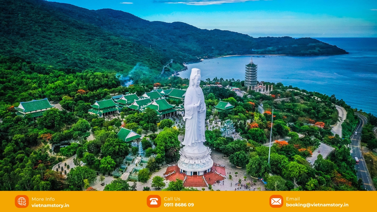
Linh Ung Bai But is the most straightforward Son Tra stop for families, seniors and travellers who mainly want the 67-metre Avalokitesvara statue, Buddhist context and sea views. Allow roughly 45–90 minutes depending on walking pace and interest.
For the statue, etiquette, free-entry policy and the difference between Da Nang’s three Linh Ung pagodas, continue to our Linh Ung Pagoda Da Nang guide.
2. Ban Co Peak: choose it for the view, not because it is mandatory

Ban Co Peak is close to 700 metres above sea level and requires a steep road approach followed by steps. Choose it when visibility is good and your group is comfortable with the road and short climb. If the upper mountain is foggy or the route is restricted, forcing Ban Co into the day usually adds more driving than value.
3. Heritage Banyan Tree: nature stop with controlled access
The official tourism portal describes the Son Tra heritage banyan as more than 800 years old, about 22 metres high, with an unusually large system of main and auxiliary trunks. Older travel articles often call it a “thousand-year-old tree”; the official estimate is more cautious.
This is a useful nature stop when its authorised access route is operating. It is not a reason to leave the controlled road and enter forest trails.
4. Tien Sa Lighthouse: check access before building the route around it
Tien Sa Lighthouse sits on the peninsula at roughly 223 metres above sea level and is one of the recognised Son Tra landmarks. Current route controls matter more than old claims about freely driving to or climbing every part of the lighthouse, so treat it as a conditional stop and follow access instructions on the day.
What should you know about red-shanked douc langurs and monkeys?
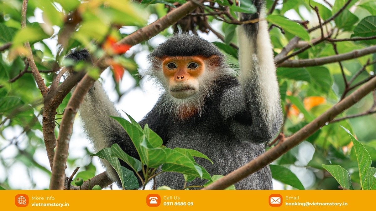
Son Tra is important habitat for the red-shanked douc langur. Wildlife is one reason to visit carefully, not a promise that animals will appear beside the road. Macaques are often easier to encounter around roads and Linh Ung Pagoda, but feeding them changes their behaviour and increases conflict with people.
- Do not feed monkeys or langurs.
- Do not chase, call, touch or approach wildlife for a photograph.
- Keep food packed away if macaques are nearby.
- Observe quietly from the road or authorised viewing area.
- Do not buy a spontaneous “wildlife trek” that enters special-use forest without clear legal permission.
In September 2026, the management board specifically warned against unauthorised trekking, ecotourism and wildlife-observation tours entering the special-use forest. Night-time wildlife trips and unofficial forest paths should not be treated as normal tourist activities.
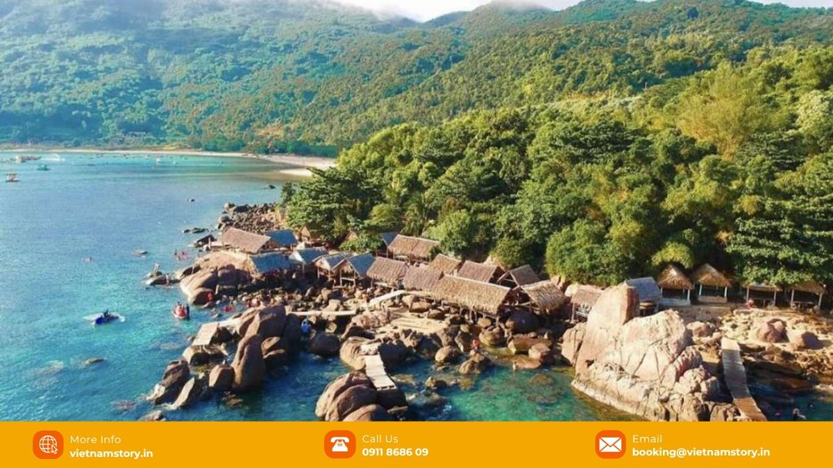
What about Mui Nghe, Bai Da Den and “hidden” trekking spots?
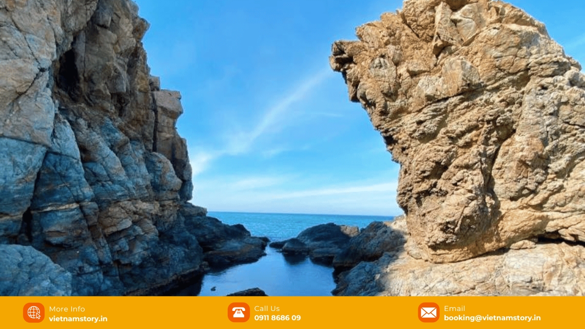
This is where the old version of the guide created the biggest safety problem. It described Mui Nghe as a challenging trek with a “natural swimming pool” and Bai Da Den as a secluded place for a gentle swim. Current management guidance is different: spontaneous trekking routes toward Mui Nghe and Bai Da Den have been identified as restricted, and visitors are told not to enter the special-use forest on unofficial paths.
Do not use an old blog, social-media reel or map pin as proof that a remote trail is open. If a cove or forest route matters to your trip, verify whether there is a currently authorised access route or licensed activity before going.
What is the best time to visit Son Tra?
For mountain visibility and road conditions, the drier period from roughly March to September is generally easier. The rainy season can bring fog, slippery roads, falling branches, rockfall and temporary closures. That does not mean Son Tra is impossible outside the dry season; it means the route should remain flexible.
| Conditions | Better plan |
|---|---|
| Clear, dry morning | Upper viewpoints such as Ban Co are more likely to justify the drive. |
| Hot midday | Prioritise Linh Ung, shaded nature stops and a shorter route. |
| Fog on upper slopes | Stay lower; do not chase a viewpoint that has no visibility. |
| Heavy rain / storm warning | Skip the mountain route and wait for the management board to reopen access. |
For the wider Da Nang season trade-offs, including beach weather and rain patterns, see our best time to visit Da Nang guide.
How much time should you allow?
| Time available | Route that usually makes sense |
|---|---|
| 1.5–2 hours | Linh Ung Pagoda only, plus one nearby coastal viewpoint if convenient. |
| 3–5 hours | Linh Ung + one upper viewpoint or authorised nature stop + breaks. |
| 6–8 hours | A fuller authorised peninsula route with pagoda, viewpoints, nature and a proper meal/rest stop. |
The official tourism portal also uses roughly 3–5 hours for a half-day and 6–8 hours for a full day. For most first-time travellers, the half-day is enough unless nature observation or slower photography is a major priority.
Where should food fit into the route?
Food does not need its own long Son Tra checklist. The easiest plan is usually to eat around the lower peninsula or return toward My Khe / central Da Nang after the mountain route. Do not rely on remote mountain roads for specific dietary requirements.
If seafood is part of the plan, use our Da Nang seafood guide for ordering, price checks and food-safety considerations. For vegetarian, Jain or Indian meals, it is more reliable to plan those around the city rather than assuming a remote Son Tra stop can meet strict requirements.
A practical Son Tra route for different travellers
| Traveller type | Route logic |
|---|---|
| First-time couple | Linh Ung + Ban Co if clear and open + one authorised nature/view stop. |
| Family with children | Linh Ung + easy viewpoint + meal; skip long, steep or uncertain routes. |
| Older travellers | Linh Ung + road-accessible viewpoint with minimal stairs; car with driver is usually the easier choice. |
| Wildlife-focused traveller | Use authorised roads, move quietly, allow time and accept that no sighting is guaranteed. |
| Rainy-season visit | Keep Son Tra optional and decide after checking current weather/access status. |
How should Son Tra fit into a wider Da Nang itinerary?
Son Tra works best as a geographically coherent half-day rather than being mixed with distant attractions just because they are popular. Linh Ung and upper Son Tra belong together. Marble Mountains, Hoi An and Ba Na Hills are separate travel zones and create more transfer time when forced into the same short block.
For the wider route across Da Nang, Hoi An, Hue and Ba Na Hills, use our Da Nang itinerary planning page only after you have decided how much of Son Tra your group actually wants.
Travelling with children, seniors or a mixed-interest group? Send your dates, hotel area and whether your priority is Linh Ung, viewpoints or wildlife. We can keep the Son Tra sequence realistic and avoid restricted or unnecessary detours.
Son Tra Peninsula FAQs
Is Son Tra Peninsula open now?
The peninsula reopened to visitors on 14 October 2026 after a temporary weather closure. Access can still be suspended again during severe weather, and visitors must use authorised routes.
What time can you visit Son Tra Peninsula?
Controlled sightseeing hours are 07:30–18:30 from March through September and 07:30–17:30 from October through February, subject to weather and route closures.
Can automatic scooters go to Ban Co Peak?
Do not assume they can. Current route regulations restrict automatic scooters on some upper Son Tra sections. Check the signs and staff instructions at the route entrance before continuing.
Can you trek to Mui Nghe or Bai Da Den?
Unauthorised trekking routes toward Mui Nghe and Bai Da Den have been restricted. Do not enter by unofficial forest trails unless a current, legally authorised route or activity has been confirmed.
Will you see red-shanked douc langurs?
Possibly, but never guaranteed. Son Tra is important habitat for the species, and the correct approach is quiet observation from authorised areas without feeding, chasing or approaching wildlife.